Mapping 5,000 Years of Human Conflict
Entry by: Cluster Labs // 09.08.2026
History is usually read through time. We wanted to see what happens when it is read through space.
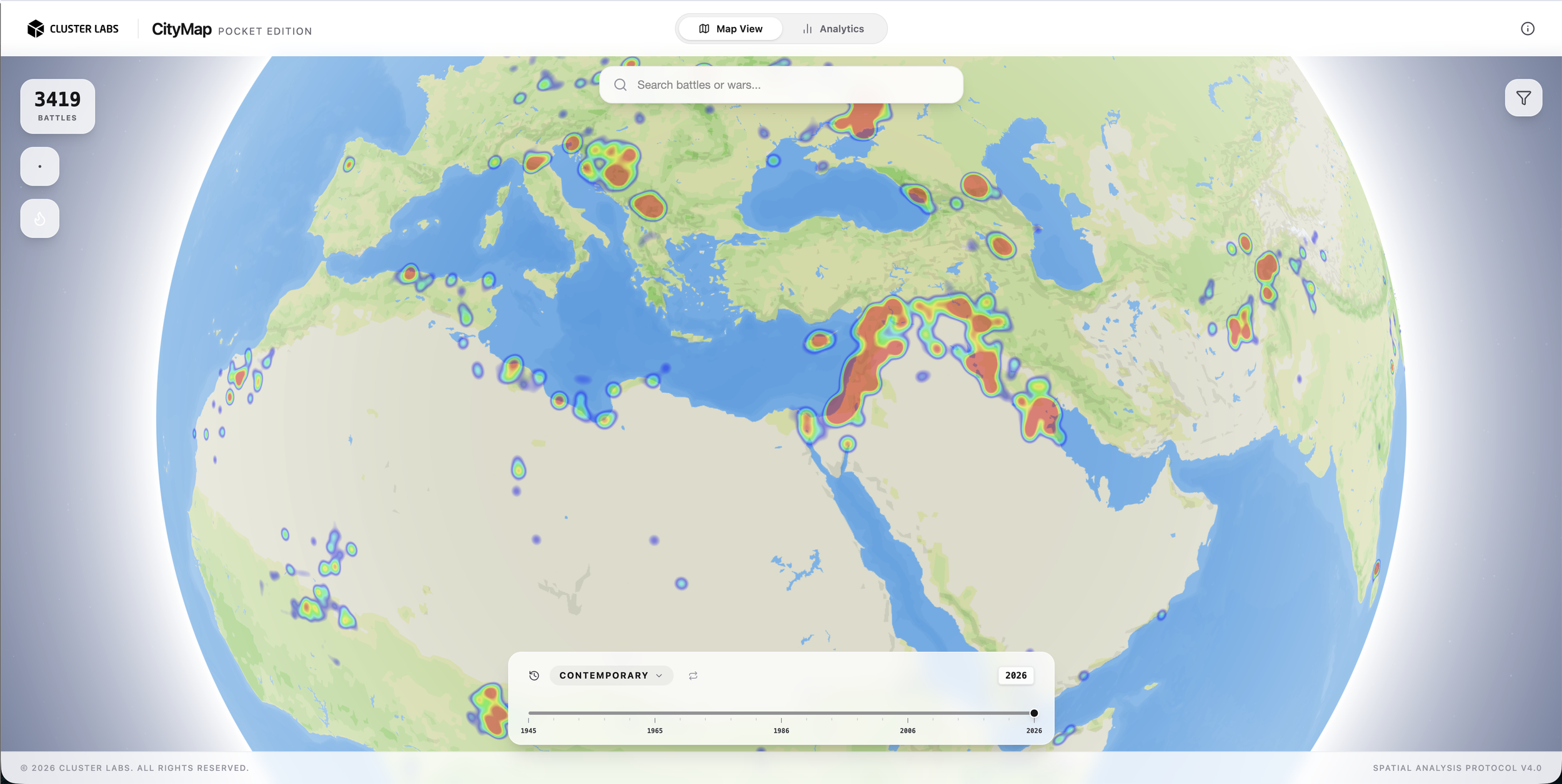
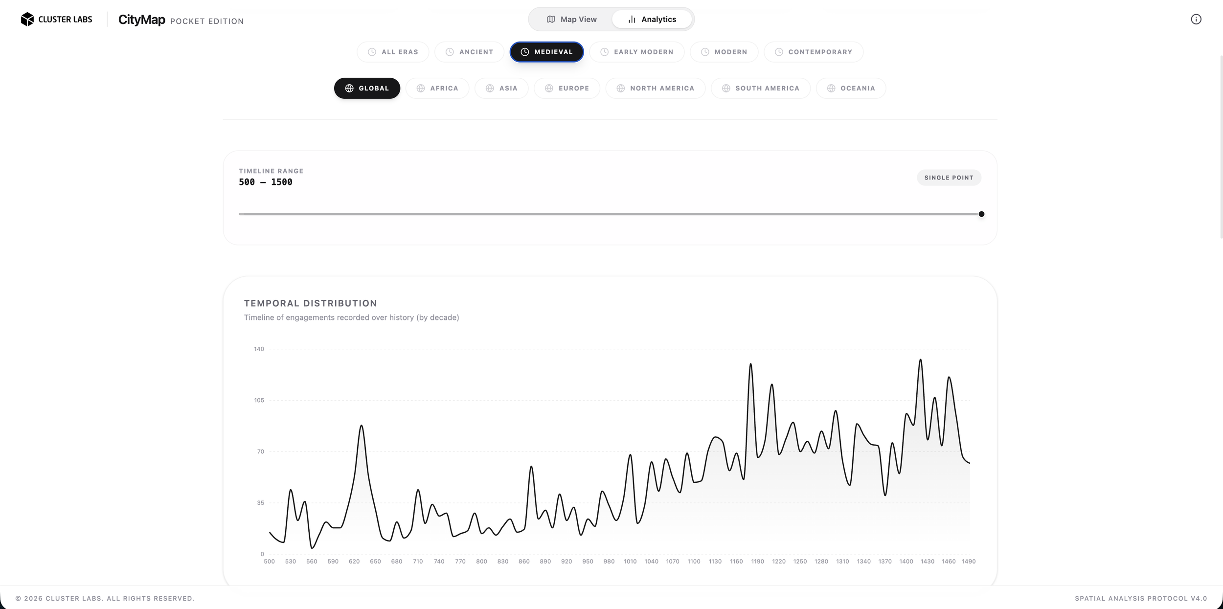
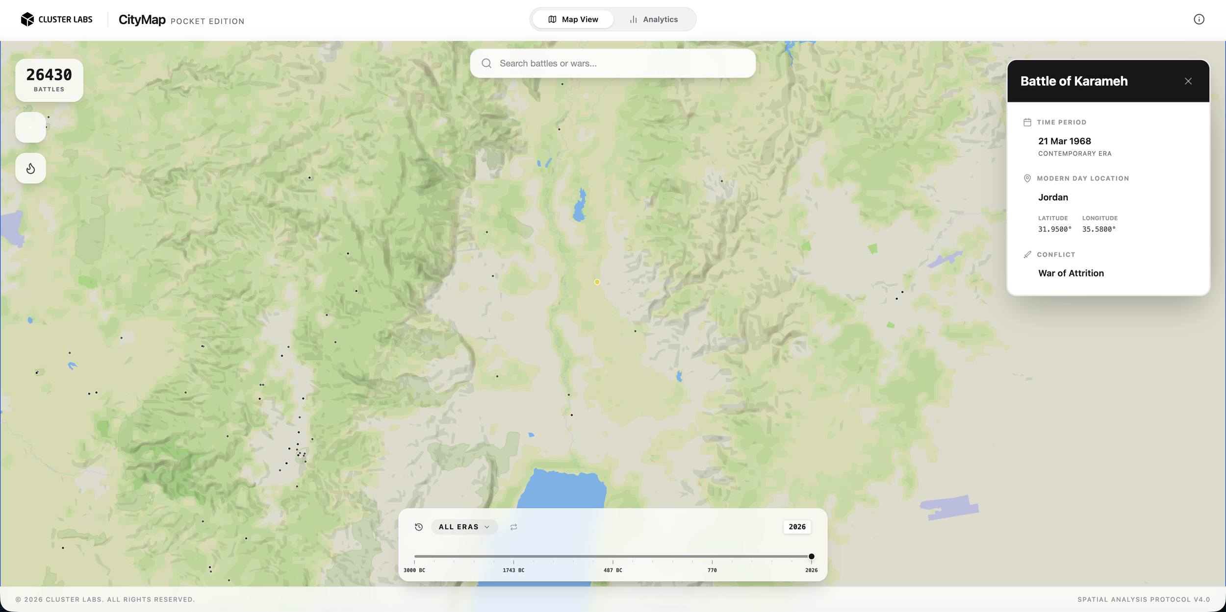
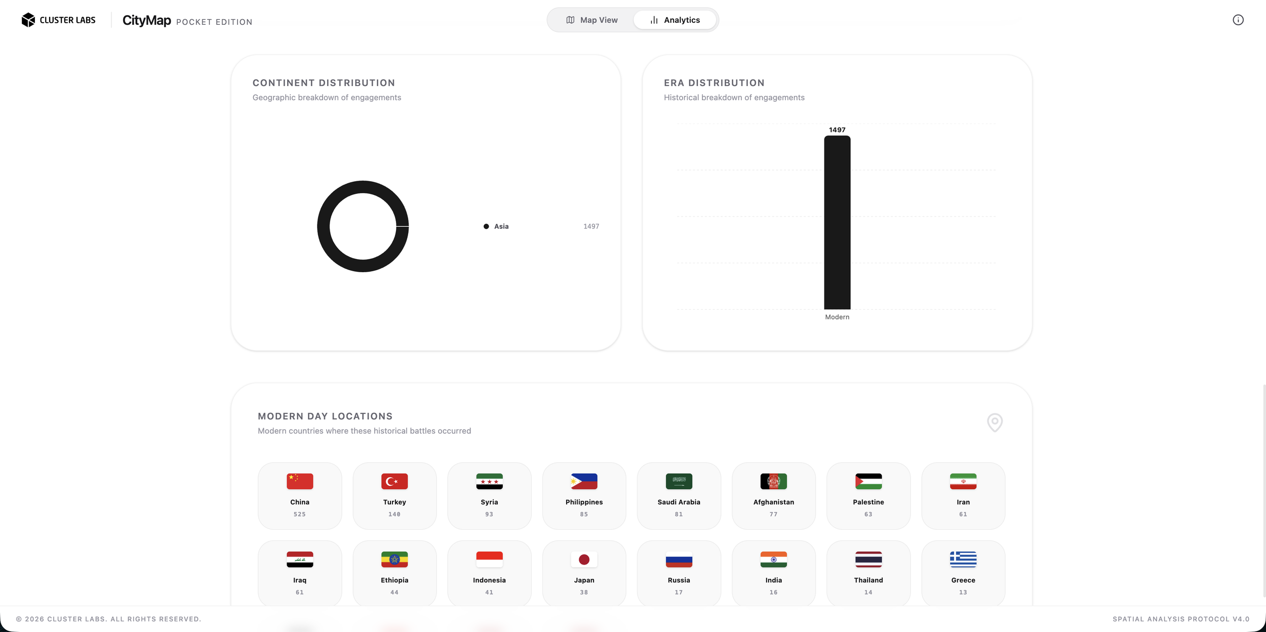
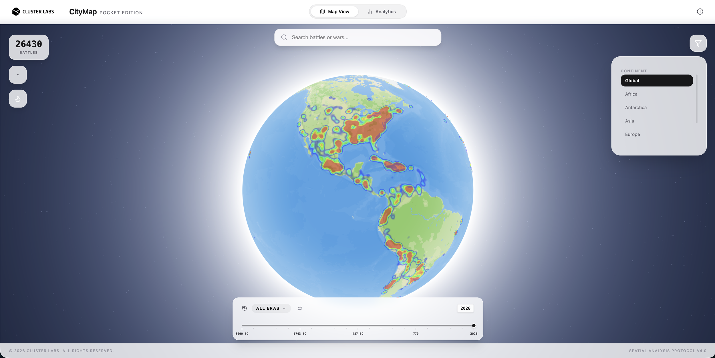
The Geography of Human Conflict is an interactive atlas mapping more than 25,000 battles across roughly 5,000 years of recorded history, using open data from Wikidata and visualized through Cluster Labs’ CityMap platform.
Viewed together, these events reveal geography as a recurring actor in human conflict: cities, rivers, coastlines, borders, trade routes and terrain repeatedly shaping where history unfolds.
The Atlas is an experiment in spatial intelligence; using maps not simply to show where things happened, but to help us see relationships, patterns and context.
جغرافيا الصراع البشري
عادةً ما يُقرأ التاريخ عبر الزمن. وقد أردنا أن نرى ما الذي يحدث حين يُقرأ عبر المكان
جغرافيا الصراع البشري أطلسٌ تفاعليّ يرسم خرائط لأكثر من 25,000 معركة على امتداد نحو 5,000 عام من التاريخ المدوَّن، مستندًا إلى بيانات مفتوحة من ويكي بيانات، ومعروضًا بصريًا عبر منصة سيتي ماب من كلاستر لابس
وعند النظر إلى هذه الأحداث مجتمعةً، تتكشّف الجغرافيا بوصفها فاعلًا متكرّرًا في الصراع البشري: فالمدن والأنهار والسواحل والحدود وطرق التجارة وطبيعة التضاريس تُحدّد مرارًا وتكرارًا المواضع التي يتشكّل فيها التاريخ
الأطلس تجربةٌ في الذكاء المكاني؛ إذ يستخدم الخرائط لا لمجرّد إظهار أين وقعت الأحداث، بل لمساعدتنا على رؤية العلاقات والأنماط والسياق